-
admin
- July 31, 2026
WebGIS development is changing how organisations collect, manage, visualise and share geospatial data. Instead of keeping maps and spatial datasets locked inside desktop GIS software, WebGIS development makes location intelligence accessible through online platforms, dashboards and geoportals that teams can use from anywhere.
For governments, NGOs, businesses, research institutions and development organisations, spatial data is only useful when it can support real decisions. A well-built WebGIS platform helps users view map layers, search locations, filter data, analyse patterns, track assets, monitor projects and communicate insights clearly.
At Kendigi Media, we support organisations with WebGIS development, geoportal development, GIS dashboards and interactive mapping platforms that make spatial data easier to access, understand and act on.
What Is WebGIS Development?
WebGIS development is the process of building web-based Geographic Information System platforms. These platforms allow users to interact with maps, layers, spatial data and analytics through a web browser.
A traditional GIS workflow may require specialised desktop software and trained technical users. WebGIS development makes GIS more accessible by creating online tools that can be used by managers, field teams, administrators, partners and decision-makers.
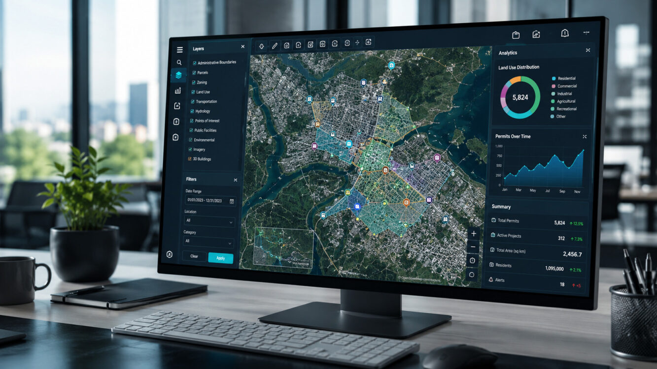
A WebGIS platform can show satellite imagery, land parcels, roads, water points, project sites, boundaries, zoning layers, environmental data, health risk areas, conflict zones or infrastructure assets. It can also include dashboards, reports, user accounts, search tools, map filters and data upload features.
In simple terms, WebGIS development turns spatial data into a digital system that people can actually use.
Why WebGIS Development Matters
Many organisations already have spatial data, but they struggle to use it effectively. The data may be stored in different files, spreadsheets, reports, field tools or desktop GIS projects. This creates problems when teams need to collaborate, report progress or make quick decisions.
WebGIS development solves this by creating a shared platform where data can be viewed, updated and analysed in one place. Instead of sending static map images or PDF reports, teams can use an interactive mapping platform that stays useful over time.
This is especially important for organisations working across multiple locations. A WebGIS platform can help show what is happening, where it is happening and what action is needed.
For example, a county government may use WebGIS development for spatial planning, land records, permitting and infrastructure monitoring. An NGO may use a geoportal to track programme sites, water points, beneficiaries, environmental risks and field reports. A business may use a GIS dashboard to monitor assets, customer coverage, routes and expansion opportunities.
WebGIS Development vs Geoportal Development
WebGIS development and geoportal development are closely related, but they are not always the same.
A WebGIS platform is usually an interactive system that allows users to view, analyse and manage geospatial data online. It may include maps, dashboards, data layers, search tools, reports and user permissions.
Geoportal development focuses more on creating a central access point for spatial data. A geoportal may allow users to search datasets, view metadata, download files, access map services and explore different geospatial resources.
In many modern projects, the two are combined. A strong geoportal can include WebGIS functionality, and a strong WebGIS platform can include geoportal features. The best approach depends on the organisation’s needs.
If the goal is to make spatial data discoverable, a geoportal may be enough. If the goal is to support daily operations, monitoring, reporting and decision-making, full WebGIS development is usually better.
Key Features of a Good WebGIS Platform
A good WebGIS platform should not just look impressive. It should solve a real organisational problem. The best WebGIS development projects begin with clear questions: Who will use the platform? What data will they need? What decisions should the platform support? What reports or outputs are required?
1. Interactive Map Interface
The map is the heart of any WebGIS platform. Users should be able to zoom, pan, switch layers, click features, view details and understand the data quickly.
The interface should be simple enough for non-technical users but powerful enough for GIS teams.
2. Layer Management
A useful WebGIS platform should allow users to turn layers on and off. These layers may include administrative boundaries, roads, parcels, facilities, land use, satellite imagery, risk zones, water points or project locations.
Layer management helps users focus on the information that matters most.
3. Search and Filtering
Search tools make a platform practical. Users should be able to search by location, parcel number, facility name, project ID, road segment, administrative area or other important fields.
Filtering allows users to narrow results by category, date, status, risk level, region or project type.
4. GIS Dashboards
Dashboards turn spatial data into quick insights. A WebGIS dashboard may show total assets, active projects, affected regions, field reports, alerts, status updates, trends and performance indicators.
This is one of the most valuable parts of WebGIS development because it helps decision-makers understand the bigger picture quickly.
5. User Roles and Permissions
Not every user should have the same access. A well-built WebGIS platform should support different user roles such as administrator, analyst, field officer, viewer, partner or public user.
This improves data security and allows the platform to serve different audiences.
6. Reports and Data Export
Organisations often need reports for management, donors, agencies or internal teams. A WebGIS platform should allow users to generate reports, export data, download maps or share outputs in usable formats.
7. Mobile and Field Access
Many geospatial projects involve field teams. A good WebGIS platform should work well on mobile devices or connect with field data collection tools.
This allows teams to collect, update and verify data from the field.
Who Needs WebGIS Development?
WebGIS development is useful for any organisation that depends on location data. It is especially valuable where many people need access to the same map, dashboard or spatial database.
County governments can use WebGIS platforms for planning, land management, infrastructure tracking, permitting and public service delivery.
NGOs and development organisations can use geoportals to manage project sites, monitor interventions, map beneficiaries and report impact.
Environmental programmes can use WebGIS development to monitor catchments, vegetation, land use, water resources and climate risks.
Transport and infrastructure agencies can use WebGIS platforms to map roads, assets, maintenance needs, incidents and network conditions.
Health programmes can use GIS dashboards for disease mapping, facility coverage, hotspot detection and surveillance reporting.
Businesses can use WebGIS development for market mapping, customer coverage, logistics planning, branch expansion and asset visibility.
Common WebGIS Development Use Cases
WebGIS development can support many types of projects. Some of the most common use cases include:
Land Information Systems
Land records become more useful when they are connected to accurate parcel maps. A WebGIS platform can help users search parcels, view ownership information, check land use, manage documents and support land administration workflows.
County Spatial Planning Platforms
Planning teams can use WebGIS development to manage zoning layers, infrastructure plans, land use maps, public facilities, environmental constraints and development priorities.
Environmental Monitoring Geoportals
Environmental organisations can use geoportals to monitor catchments, forests, wetlands, land degradation, water quality, vegetation change and climate resilience indicators.
Road Network and Asset Mapping
Transport GIS platforms can help agencies manage roads, bridges, road assets, maintenance sections, traffic incidents and road condition data.
Disease Surveillance Dashboards
Health teams can use WebGIS platforms to map disease cases, identify hotspots, monitor risk patterns and support targeted interventions.
Resource and Conflict Mapping
Organisations working in peacebuilding, natural resources or humanitarian response can use GIS dashboards to understand conflict incidents, water points, grazing areas, migration routes and risk zones.
Recommended Technology Stack for WebGIS Development
The right technology stack depends on the project, budget, users and hosting requirements. However, many strong WebGIS development projects use open-source geospatial technologies because they are flexible, scalable and cost-effective.
A common WebGIS stack may include:
PostGIS for spatial database management
GeoServer for serving geospatial data and map services
OpenLayers for interactive web mapping
FastAPI for backend development
Docker Compose for deployment and environment management
Python geospatial tools for analysis, processing and automation
This type of stack can support powerful geoportal development, spatial data management, dashboards, user access and custom mapping workflows.
Mistakes to Avoid in WebGIS Development
A WebGIS platform can fail if it is built without a clear strategy. The most common mistake is starting with design before understanding the data, users and decisions the platform needs to support.
Another mistake is building a platform that only GIS experts can use. A good WebGIS system should be useful to decision-makers, programme managers, administrators and field teams, not just technical staff.
Poor data structure is also a major problem. If the spatial database is not designed properly, the platform may become slow, confusing or difficult to maintain.
Organisations should also avoid building a platform without training. WebGIS development should include user onboarding, documentation and capacity building so teams can actually use the system after launch.
How Kendigi Media Supports WebGIS Development
Kendigi Media helps organisations design and build WebGIS platforms, geoportals, GIS dashboards and spatial data systems that support real decision-making.
Our approach begins with understanding the organisation’s goals, users, data and required outputs. We then help structure the spatial database, design the platform architecture, develop the map interface, build dashboards, configure user roles and support deployment.
Kendigi’s project experience includes WebGIS portals, land information systems, parcel generation tools, transport GIS, disease mapping, spatial planning and digital platforms. This gives us a practical understanding of how geospatial systems should work in real-world organisational environments.
Whether an organisation needs a public geoportal, an internal GIS dashboard, a land records platform, a planning system or a monitoring portal, Kendigi helps turn spatial data into a practical digital solution.
Benefits of Investing in WebGIS Development
WebGIS development gives organisations a better way to manage and use spatial data. Instead of relying on static files, scattered spreadsheets or isolated desktop systems, teams can work from a shared online platform.
The benefits include better collaboration, faster reporting, improved data visibility, stronger decision-making, easier stakeholder communication and more efficient project monitoring.
A WebGIS platform can also reduce duplication. When everyone works from the same source of spatial data, there is less confusion and more consistency.
For organisations that need accountability, WebGIS development can make reporting more transparent. Maps, dashboards and geoportals help stakeholders understand where work is happening and what progress has been made.
When Should You Build a WebGIS Platform?
Your organisation should consider WebGIS development if location data is central to your work and many people need to access, update or understand that data.
You may need a WebGIS platform if your team keeps asking questions like:
Where are our assets located?
Which projects are active?
Which areas are underserved?
Which regions are high risk?
Which parcels, roads or facilities need attention?
Where are field reports coming from?
How can we share spatial data with stakeholders?
If these questions matter to your organisation, a WebGIS platform can help.
Conclusion
WebGIS development helps organisations move from static maps and scattered spatial files to interactive platforms that support real decisions. Through geoportals, GIS dashboards, spatial databases and web mapping tools, organisations can make location data easier to access, analyse and share.
For governments, NGOs, businesses and development organisations, WebGIS development can improve planning, monitoring, reporting, land management, environmental analysis, health surveillance and infrastructure visibility.
Kendigi Media supports organisations that need practical, scalable and decision-focused WebGIS platforms. If your organisation wants to turn geospatial data into a useful online system, Kendigi can help you build the right solution.
Frequently Asked Questions About WebGIS Development
What is WebGIS development?
WebGIS development is the process of building online GIS platforms that allow users to view, manage, analyse and share spatial data through a web browser.
What is the difference between WebGIS and desktop GIS?
Desktop GIS is usually installed on a computer and used by technical GIS professionals. WebGIS runs online and allows more users to access maps, dashboards and spatial data through a browser.
What is geoportal development?
Geoportal development involves building a central online platform where users can discover, view, manage or download geospatial data and map services.
Who needs WebGIS development?
Governments, NGOs, environmental programmes, land agencies, health organisations, transport agencies, research institutions and businesses can all benefit from WebGIS development.
Can a WebGIS platform include dashboards?
Yes. A WebGIS platform can include GIS dashboards with maps, charts, filters, KPIs, alerts, reports and data visualisation tools.
What data can be used in a WebGIS platform?
A WebGIS platform can use parcels, roads, boundaries, satellite imagery, project sites, health data, environmental data, field reports, infrastructure assets and other spatial datasets.
Is WebGIS development useful for NGOs?
Yes. NGOs can use WebGIS platforms to map project sites, track field activities, monitor impact, manage resources and report results to stakeholders.
Can Kendigi build a custom WebGIS platform?
Yes. Kendigi Media supports custom WebGIS development, geoportal development, GIS dashboards, spatial databases and interactive mapping platforms for organisations that need location-based decision support.